Showing posts with label Walking Routes. Show all posts

Wednesday, 3 November 2010

Tenerife Walking with Children

Ever since I first pulled on a pair of walking boots and set off down a country lane, I've realised that  walking and hiking isn't, as I once thought, the exclusive domain of anoraks and middle aged dog owners. For us, the fun factor has always been top of the agenda which means that dull, route marches are given a wide body swerve and every outing should end with a beer or two in a local hostelry.

It was while answering a query last week from a customer about walking with youngsters that I realised how many of our Island Walks are actually excellent for families. It's one of the great things about walking on Tenerife that you can still find so much ' undeveloped space filled with surprises that make it the perfect environment for family outings.
Here are some of our favourites [read the full post]

Saturday, 31 July 2010

Walk Tenerife from El Palmar to Teno Alto

This is the stunning El Palmar Valley; a secret paradise in Tenerife's north east corner. It's through this valley that the wonderful El Palmar to Teno Alto walk climbs.

You can read about the walk on our new website [...]

Tuesday, 27 July 2010

Discover Great Hiking in the South West of Tenerife

For many, the south west of Tenerife represents the perfect holiday destination, enjoying as it does some of the longest sunshine hours on the island.
Less frenetic than Playa de Las Américas, better value for money than Costa Adeje and more rural than Los Cristianos, the coast which stretches from Los Gigantes in the west to Playa Paraíso in the south encompasses a diverse selection of resorts.
Backed by colossal cliffs, Los Gigantes is a family resort in a spectacular location where whale and dolphin watching cruises operate from its picturesque marina.
Moving south along the coast, Puerto de Santiago has great fish restaurants around its unpretentious harbour while neighbouring Playa de la Arena gets the blue ribbon award for its clean and sheltered beach.
Little Alcalá brings a Canarian/South American character to the coast and Playa de San Juan provides [read the full blog at our new site]

Thursday, 8 July 2010

Enjoy a Tenerife Holiday Walk


You don't have to be a committed hiker or a keep fit fanatic to enjoy a holiday walk in Tenerife.

Regardless of where you're staying on the island, you'll find a nice holiday walk close by which will stretch your legs and allow you to see something other than the beach or your hotel pool during your visit.

With Island Walks, we have a whole series of suggested routes to suit everyone from the keenest of hikers to those just looking for a nice holiday walk. Island Walks cover a wide geographical spread of Tenerife so that wherever you're staying; whether you're dependant on public transport or intend to hire a car, there's a walk or two to suit... [read more]

Thursday, 10 June 2010

Walking Directions on Tenerife – The Chinyero Volcano – Almost Perfect Signage…Almost


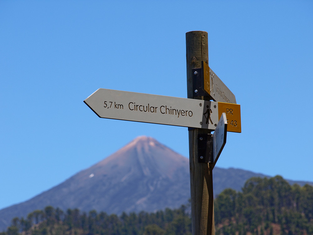
This week we thought we were going to have to eat our words about the lack of consistency regarding official walking signage on Tenerife when we ‘oohed’ and ‘aahed’ at the lovely brand new signs leading us to the Chinyero Volcano in the west of the island.

Admittedly getting to the actual walk had involved ignoring a signpost which suggested that the road to the start of the walk may or may not have been shut – it wasn’t – and then knowing where the actual walk began as the signposts didn’t start till we were on the walk. This sort of flawed thinking runs through a lot of Canarian thinking. You have to know that something exists, and where it exists to find out more info about it. It means that if you’re a visitor, there are a lot of things going on that you never get to hear about. Walking routes don’t just start at the first signpost.

But being already armed with this info, this potential stumbling block at the start didn’t pose a problem. To be honest, I didn’t even think about it until I started writing this. It’s something we have to remind ourselves of on a regular basis – to try to look at walks through the eyes of someone who isn’t overly familiar with Tenerife or its quirky little ways.

Anyway we set off along a new and very clear path and at every crossroads there were signs complete with distances. Okay, the angle of a couple might not have been perfect, but that’s being overly picky.
It was one of, if not the clearest marked walking route that we’ve experienced on Tenerife and was getting the thumbs up from us as the perfect walking route. This was looking like a shining example of what the future of Tenerife as a top walking destination could look like.

But this is Tenerife; where the illogical is almost compulsory. As we reached a point in the walk which was less than a couple of hundred yards from the Boca Tauce road and therefore a perfect spot for walkers to access the route from the south and south west, the path completely ignored this and continued parallel with the road before heading inland again.

Not only were there no signs from the path to the road, or vice versa, there were yellow and white crosses advising that it was definitely not part of the route.

Basically this was a walk which was perfectly laid out for people starting from the northern side of the island, but people on the southern side might not be aware it existed even though they were only metres from it. It was bizarre and I can’t quite figure out, considering the care and attention that went into signposting the rest of the walk, why there was such a serious omission at that point.

But there you go; ours is not to reason why, ours is but to do and…discover.

Monday, 31 May 2010

Walking on Tenerife – all that glistens is not gold.

 
We often get asked about walking routes in the west by people who are planning to holiday in and around Los Gigantes. So over the past couple of weeks we’ve been concentrating on that area and trying out some walks.

We knew that there was an old trading path running from somewhere around Guía de Isora up into the hills so last week we set off to find it. We were working off information supplied by the Ayuntamiento (Town Hall) which, as usual, was reprinted on a regular basis without anyone checking if it was still current.
Consequently, the start of the route had long since disappeared, replaced by new roads and walls.

After a precipitous false start and some hesitant exploration, we finally found the route and once we were on our way, were pleasantly surprised to find that it was in fact well signed and easy to navigate. At multiple path junctions, signposts gave good directions and distances, routes were way-marked with painted stripes and there were even information boards at various points, showcasing other routes.

Having enjoyed and chronicled a lovely, rural, circular route we emerged back into Guía alongside someone’s house, at the bottom of a dead end, accessed via a series of climbs, twists and turns through housing estates, with not a single signpost to mark it. Had we been looking to start the walk from that side, we would probably still be wandering around Guía now.

That same afternoon we drove further up into the hills to do a short(ish) route at the start of which a brand new, fancy sign had been erected by the Cabildo (Island Government).
Within metres of setting off from the sign, we were unsure of which way to go, our indecision hampered by two small dogs growling and snapping at our heels. Once we’d found an overgrown semblance of a path, it split off in different directions constantly with no marker signs for guidance. Although we were alongside a steep barranco (ravine) and so our direction was pretty obvious, finding the way through was proving to be impossible.

After aborted attempts to drop down dodgy trails on the side of the barranco, we finally found our path completely blocked by two parked vans alongside a house. Re-tracing steps; trying different trails and even asking a couple of locals all amounted to nothing. We finally gave up, tired and frustrated with feet embedded with sharp seed heads from wading through the tangled mass of undergrowth.
The Medio Ambiente (Environmental Department) had clearly decided to re-open the path and had begun by putting up the fancy sign. When, or if, they’ll get round to re-claiming the path from man and nature and giving it clear markings is anybody’s guess.

The moral of this tale is that, on Tenerife, you can’t tell a walk from its signpost.

Walking routes for the south west coming soon…

Sunday, 11 April 2010

Tenerife Walking Guides - Teide National Park.


I seem to have some kind of timing mechanism in my head which, if it doesn’t get away from a screen and into the mountains or valleys of Tenerife on a regular basis, starts to emit a dull whining sound which blocks all creative thought.
Of course, that’s just an elaborate way of saying that I can only survive so long before going on a walk – it’s food for the soul.

We’ve been trying to put the finishing touches to our latest Tenerife walking guide – Hiking Highs;Teide National Park – but we’ve been incredibly busy for months now (yay!!) and haven’t had time to map out the final route…until last Monday when we broke free and headed up into the crater.

We’d timed it perfectly as the high cloud that’s been hanging around for a couple of days finally lifted and Teide National Park lay below her customary intensely blue sky. The last vestiges of snow on the peak are diminishing daily as the sun climbs higher and now the spring flowers have burst into bloom. This is a wonderful time of year to go walking in the National Park.

Setting off from the El Portillo Visitor centre, the large white flowers of Teide broom and the elegant indigo stems of Tajinaste Azul accompanied us as we climbed gently above the crater, the twin peaks of La Palma emerging above the sea of clouds on our horizon.

It’s an incredible feeling to be in such a surreal landscape with the sun on your back and only the lizards and canaries for company. Mount Teide was her usual, stunning best and from our vantage point we could clearly see the path that leads over Montaña Blanca before climbing steeply to the summit. Skirting the edge of a spectacular gorge of wind-eroded rocks, we arrived at the top of the Arenas Negras volcanic cone. Then we regressed to giggling childhood as half running, half surfing, we descended its black cinder face, covering a distance in 15 minutes that had taken us 40 minutes to ascend.

Teide National Park is so many things; an alien landscape; a geological masterpiece; home to a mysterious creature known as the mouflon; a hiker’s paradise and a giant playground where you can take a cable car white knuckle ride to see an archipelago in satellite mode and surf volcanoes. Where else on this planet can boast as much?

The ‘Hiking Highs;Teide National Park’ walking guide is now available to buy and have delivered directly  to your email within 24 hours.

Tuesday, 26 January 2010

Visions in Pink - The Almond Trees of Santiago del Teide, Tenerife


The Santiago del Teide Valley is an uplifting place to walk at any time of the year – old farmers in fedora hats stop their backbreaking work tending fields to wave as you walk by, old women in straw hats gossip on the corners of a small hamlet and the scenery shifts from gentle agricultural lands to pine forest to bizarre volcanic formations – but in January and February it is positively magical.

This is the time when the almond trees blossom and fill parts of the valley with their delicate pink flowers. They are a beautiful if short-lived sight to behold and make exploring the area that little bit more special.

For anyone who’s lucky enough to be on Tenerife during this blooming marvelous time and who wants to discover the charms of the Santiago Valley for themselves our ‘Into the Valley’ walking route traverses much of the valley.

Tenerife Island Walks are always a real joy to put together and the Santiago del Teide Valley route was no exception. The routes which follow former merchant and Guanche shepherd trails have some moments where the scenery is so stunning it could almost knock you on to your backside. Standing overlooking the valley with the road snaking to Masca on the opposite valley wall and La Palma, La Gomera and occasionally El Hierro floating on the horizon comes as a standard 'WOW' moment on this walk.

At this time of year, the flowering almond trees are just an added bonus.

The Santiago del Teide council organizes guided ‘Ruta del Almendro en Flor’ (Almond Trees in Flower Route) each February. This year’s takes place on the 6th, but such is the popularity that it’s already full – however, it does give you an idea of around which date the locals consider it best to view the almonds in flower.


Sunday, 20 December 2009

Sunday Strolling


The eastern coast of Tenerife is the part that every visitor sees as they whiz along the TF1 motorway from the airport to their resort, and back again. Very few visitors ever spend any time there which means that, when it comes to walking, you’re quite likely to have the whole place virtually to yourself.

Last Sunday we wanted to do a short walk with a friend of ours who lives in the south of the island. The weather had been cloudy and damp just about everywhere on the island and the forecast was for more rain so we wanted somewhere that was a) our best shot at catching dry weather b) somewhere half way for us each to travel and c) in or around 2 hours maximum with a nice restaurant in which to end with lunch.
There was just one place that fitted the bill perfectly; the Güímar Malpaís.

Starting at the little port of El Puertito, we ambled across the badlands alongside the sea amidst great swathes of tabaiba, cardón and sea lettuce. In the spring and summer, the grasses are tall and green but in winter they’re brown and wispy, rippling the landscape in the breeze.
Crossing the lava fields we headed inland to Montaña Grande and skirted the base before heading back on a different route to the fish and seafood cafes and restaurants of Puertito. An idyllic little 2 hour circular stroll with views along the coast northwards to Las Teresitas beach and Santa Cruz and southwards to the lighthouse at Poris de Abona.

And if you’re staying in the south of the island, there’s a fantastic drive that takes you to El Puertito along the old Forgotten Road so you can combine touring with walking…perfect.


Sunday, 22 November 2009

Good News for Tenerife Walkers

The press invitation had quite clearly stated that walking shoes and warm clothing should be worn but it seems that for the staff of the local Town Hall, a visit from the President of the Tenerife Council was too important an occasion not to dress up for.

18th November was the 100th anniversary of Tenerife’s last volcanic eruption which came from Mount Chinyero in the pine forests of Santiago del Teide municipality. To mark the anniversary a plaque was to be unveiled at the foot of the volcano and some doves were to be released to fly over the frozen black lava that today fills the landscape.

Heeding the advice in the invitation and wearing sensible shoes and a warm jacket, I had to stifle my giggles as I watched the ‘suits’ from the Island Council and the local Town Hall trying to walk over the lava fields to where the plaque was being unveiled. Even funnier were the women, one in little white ballet-type shoes, one in gold sandals and one in high heel knee boots.
Apart from the Dick Emery type gait that they all had to adopt as they slipped and wobbled on the pumice rocks, they all had hunched shoulders and goose-pimply flesh from the distinctly nippy breeze that was blowing around the volcano.


Still, plaque uncovered and doves released, we all trooped our way back to the Casa del Patio in Santiago del Teide for the much more sedate second part of the centenary celebration.
Casa del Patio is the 17th century former home of the Hoyo y Solórzano family who used to own Santiago del Teide and it has now been beautifully restored by the Tenerife Council. Housing a permanent exhibition to the Chinyero eruption of 1909, this was the perfect occasion to officially open the Casa to the public.


It’s in an idyllic setting just behind the church in Santiago del Teide and stepping through the gates is like stepping back in time. Apart from the assorted cockerel, ducks and geese underfoot, there’s a wine museum, a wonderfully atmospheric Tasca with cheeses, hams and local wine and a rather elegant restaurant. There are also riding stables and there are plans to open riding trails locally so everyone can enjoy the spectacular scenery on horseback, the way many locals still do.
If you’re planning a trip to Masca I recommend stopping off here for an hour to wander the grounds, browse the shop and museums and sample some local produce at the Tasca.

Best of all, there’s a small rural hotel on the site which is due to be opened shortly and which will be the perfect stopover for hikers.
The trails around Santiago del Teide valley are some of the most diverse on Tenerife with terrain moving from lush, wild flower-filled valley, to pine forest and frozen lava fields around Mount Chinyero. You even move through climate zones from the humid, cooler Erjos Pools to the arid south at Arguayo. Walking these hills and valleys is akin to walking on at least three different islands.

When Casa del Patio Rural Hotel opens we’ll be able to combine a great day’s walking with a night in a stylishly rustic hotel and lunch at the Tasca.
Now that’s something to look forward to.

Friday, 30 October 2009

Walking in the South of Tenerife


The most enquiries we get from people about walking on Tenerife are:
1) I’m staying in the south and would like some walks within easy distance and
2) do you have any walks that aren’t too long?

Well, if I was a stone, I might just have killed two birds…

This week we’ve published ‘The Old South’ which is a series of five walks set, as the name suggests, in and around the south of Tenerife.
They range from an ancient trading route which takes you through the pretty hamlet of San Miguel before heading out into idyllic rural scenery and spectacular views, to pine forests and cliff-side paths above plunging ravines with magnificent vistas over Costa Adeje.
From above barrancos to within barrancos and from village to valley, all the walks in The Old South are less than 3 hours in duration and can easily be done by any reasonably fit person without the aid of breathing apparatus!

You can buy ‘The Old South’ for just €2 or you can buy the whole Island Walks series for just €6. Every purchase gets a free copy of ‘A Captivating Coastline’ which gives you a free bonus of five beautiful Tenerife coastal walks.
Happy hiking!

Friday, 23 October 2009

Fuzzy Walking Directions – A Recipe for Disaster

The term ‘recipe’ seems quite appropriate to use when talking about walking routes, especially when talking about writing walking routes.

Let’s be honest here, most walking routes anywhere have been written out any number of times by any number of people over the years. It’s very rare to find a completely ‘new’ walking route, but that doesn’t mean to say that there’s not something fresh to say, or a different approach to take.

It’s the same with recipes. Most recipes are variations on ones which have been handed down through families or recorded in cook books over aeons. But that doesn’t mean that there’s nothing new about the recipe. A dash of cumin here, a sprinkling of fresh herbs there and you’ve got something which improves on the original.

I bet you’re wondering where I’m going with this…hang on in there, I’ll get there in the end.

The recipe analogy came into my head the other day as I surveyed a bewildering noughts and crosses grid of identical looking paths heading in all sorts of directions. I’m sure from the air it must have looked like one of those ‘landing strip for flying saucers’ images from Erich Von Däniken’s Chariots of the Gods.

I was heading up to the summit of Montaña Guaza beside Los Cristianos and had reached a crossroads of paths which had me scratching my head in confusion.

You might be thinking, ‘surely if you’re heading to the summit of a mountain, it’s pretty obvious which way to go… up’.

And normally I’d agree, but in this situation I was following instructions which very clearly told me, against my better judgement I have to add, to ignore the obvious and then held me tightly by the hand until they deserted me at the crisscross of paths at which point they ran off into the distance feebly shouting ‘I’ll meet you again when the path becomes a bit clearer.’

It was like following a recipe for a curry which, when it got to the stage of adding the exotic seasonings, told you to ‘now add some spices’ but didn’t tell you which ones.

I was pretty peed off, especially as It’s not the first time this has happened with these particular ‘walking instructions’ and decided to do what Andy and I regularly decide to do when trying to work out what we think is the best walking route – follow our instincts. More often than not this ends up being our way of adding those extra tasty spices and handfuls of aromatic fresh herbs.

As it turned out the route we would have followed, had the directions not told us otherwise, was the most direct and was much, much simpler. God knows why we were encouraged to go off on some wild goose chase.

But once again this is exactly one of the reasons we are putting together a series of walking routes for Tenerife which we think are more user friendly than… well anything we’ve come across yet.

We’ve specifically designed them so that they look great and are full of beautiful photographs and interesting snippets of information about the area and what people should look out for.

However, the most important aspect of them for us is this.

Unlike the instructions we were using which basically just ignored the fact that there were paths in all directions, we want to be there holding your hand, saying ‘don’t worry; we’ll stick with you all the way, especially when the path ahead is unclear.’

P.S. Our version of which route to take up Montaña Guaza is now available as part of our new ‘Island Walks – The Old South Routes’.

Monday, 19 October 2009

Walking on Tenerife - The Medio Ambiente Are Still Trying to Kill Me

I had no idea what to do. I squatted down and peered at the ground in front of me… nothing, not even the slightest suggestion of a path. I was a pine needle’s width away from putting my ear to the ground; not for any particular reason other than it looked good when Hawkeye did it in Last of the Mohicans and Aragorn in Lord of the Rings.

The forest stretched almost from horizon to horizon in front of us (well that’s what it seemed like), every inch of it looking exactly the same. Only Mount Teide dominating the horizon to the right provided an indication that at least the general direction we were going was right.

The Medio Ambiente had done it again. They’d sent us off into the wilderness with shiny new signs which kept us welcome company where the path was clear and which deserted us completely when it wasn’t. And now we were in danger of becoming lost forever… or a few hours anyway.

To be fair I can’t lay all the blame at their door. Although we were on a former official walking route, we had strayed from the new path that, for some strange reason, the Medio Ambiente now wanted us to follow.

We were in the hills above El Tanque with friends Richard, Nikki and Basil of Tenerife Dogs fame. Basil was unperturbed by this turn of events, enjoying his frolic in the forest, whereas the rest of us stared at the expanse of forest in front with expressions which must have matched those of the 300 Spartans facing the Persian army at Thermopylae.

It had started out well enough with an easy stroll along a clear path through the pines from the recreation zone at Arenas Negras. The first alarm bells should have sounded when a signpost, which had pointed the way 18 months ago, didn’t appear where it should have done. Still, there was only one clear path and we followed it although it veered away from the way we were sure we wanted to go.

The signposts along it looked shiny and new; something which would normally be helpful. On Tenerife this isn’t always the case. Eventually we arrived at a path which circled the Chinyero Volcano, not the place we intended to be at all, and decided to retrace our steps and follow another new sign to San José. The route took us back in the right direction; however, within a few minutes the path became almost anonymous and there was a severe shortage of any helpful signposts whatsoever. A strategy of fanning out like a police line looking for a body helped get us back on track and we eventually joined up with a main path beside the impressive looking black and rust coloured cone at Arenas Negras.

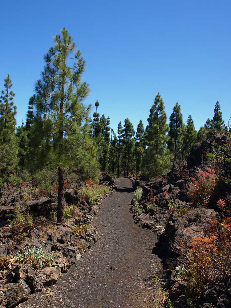
We followed the ‘unofficial’, but more interesting, path around the volcano through a strange landscape of scattered pines, with perfect circles of tobacco coloured fallen pine needles at their base, and uneven lava formations. The path was easy to follow and the views of Mount Teide and the peaks of La Palma breaking the sea of clouds were breath stealers.

All was well with the world until we reached the point where the path completely disappeared.

I remembered similar happening the last time we walked this route, but this time I had an ace card. There was a small campsite of wooden chalets which was right above the end of our route and which should have become visible as we walked in a straight line from the end of the clear path… except this time there wasn’t.

We stared and stared at the forest, but there were no hints to the right direction, nothing… apart from the thinnest of straws. A flattish section of the forest up a slope to our right looked vaguely familiar and sort of like the spot where the chalets had been, but even as I climbed I knew that it was more in vain hope than anything else. Sure enough I reached the top and my hopes were dashed; there were no chalets. Unsure of what to do next I wandered a few feet to a ridge to think what I was going to tell the others…and there below me was the recreation zone where we’d started.

The relief was palpable and we were able to enjoy our bocadillo lunch at the comfort of a picnic table before heading to Fleytas Bar for the most welcome of post walk beers to debate what had happened to the chalets.

This experience is exactly the reason we have written walking routes on Tenerife and this particular route will be coming your way sometime in the near future – as soon as we can figure a way out to describe a path through a forest where everything looks exactly the same.

Monday, 12 October 2009

Walking on Tenerife – The Mystery of the Adeje Troll

Something spooky is going on in ‘them thar hills’ above Adeje.

A couple of years ago we spent quite a bit of time walking in the Adeje Mountains as research for the ‘Walkabout’ series we were writing for Living Tenerife Magazine. On one path we came across a particularly strange rock formation which looked like a face; a troll’s face to be exact. I took a couple of photos of it, so here’s the proof that it wasn’t simply a hallucination brought about by sniffing some toxic flora along the way (not that there was any, but the smell of curry plants at one point had been quite intoxicating).

Last weekend we returned to the area to map out some routes in more detail in preparation for our new ‘Walks in the Old South’ addition to the Real Tenerife Island Walks series and as we drew closer to the area where we’d seen troll face we kept a look out for his distinctive features.

However, he’d gone!

At first we assumed we must have missed him, even though he had been right beside the path, and the return journey turned into a mission to find him. But as we passed the spot where I was 99.9% certain he’d been, he simply wasn’t there.

Maybe he really had been a troll and after we’d published his photo decided his cover had been blown, so upped sticks and headed deeper into the forest.

Or maybe his face had simply eroded. Personally, I much prefer the first explanation. The World needs a bit of magic now and again.

Sunday, 11 October 2009

Tenerife Lizards

Wherever you walk on Tenerife it’s a fairly safe bet that you’ll be accompanied by lizards scuttling around in the undergrowth and playing ‘chicken’ across the path in front of you.
It never ceases to amaze me how these painfully shy creatures suddenly turn into your best mates the moment you get your butties out of the rucksack. I reckon it’s evolution; lizards have learned that the crinkle of foil or the rustle of plastic equals crumbs.

Yesterday was hike-athon day for us. Three hikes in one day, an arduous feat as my buttocks will now attest. The final hike was from San Miguel de Abona to La Centinela Mirador and as we sat on a bench overlooking the southern landscape I remembered the last time we were here. We’d sat down on the same bench to eat our lunch and within seconds lizards popped up from everywhere grabbing the crumbs we threw and disappearing back into the undergrowth with them.

One time we were hiking through an overgrown barranco in Guimar and we nearly stepped on a lizard that was peeking out from a crevice in the path. We stopped and Jack started photographing it at close range. We were amazed how confident the little fellow was. He didn’t move at all despite the close proximity of the camera lens. We must have been there for 3 or 4 minutes before I sensed that something was wrong. The lizard was actually trapped. He’d got the top half of his body through the crevice and was firmly stuck. Who knows how long the poor thing had been there and more importantly, how long he would still be there had we not come along. This was an abandoned barranco that was extremely difficult to navigate and clearly hadn’t been traversed for a very long time. In all likelihood he would have starved to death there.


Jack carefully dislodged a couple of rocks and the lizard wriggled free. For a moment he just stood there, as if he couldn’t quite believe what had just happened, and then he was off, scuttling into the undergrowth and away, already composing the narrative he would tell his children and grandchildren.

The experience gave us a warm glow, a combination of feeling really good that we’d just saved a life and mortification that we’d spent several minutes photographing the poor thing in the throes of his ordeal.
So next time you’re hiking, keep an eye out and pack some extra crumbs for the lizard life.
And if you're interested in some walking routes in the south of Tenerife, you'll love our selection of the best southern walks in 'The Old South' - only €2 including your FREE copy of our favourite Tenerife coastal walks, 'Captivating Coastline'. Buy online for delivery to your in box.

Thursday, 8 October 2009

Walking on Tenerife – The Closure of the Barranco del Infierno

Back in August we told you that the Barranco del Infierno was closed for a bit of a facelift.
It was estimated that the work would take a few weeks to complete.So, working on a formula specifically developed for Tenerife – take the official estimate and double it – we thought that it was time to check with the people at the Barranco del Infierno how things were progressing.

The bad news is that the Barranco is still closed. The good news is that the person we spoke to reckoned that it should be open again by around mid October. The typically Tenerife uncertain news is that he added a ‘mas o menos’ at the end.

Now we’re guessing November, but watch this space.

Thursday, 1 October 2009

Walking on Tenerife – Simply Stunning Scenery from Off the Beaten Track #2

We have two very contrasting areas which involve heading above the clouds for our ‘Stunning Scenery’ shots this month. The first is still an area which is relatively unexplored by visitors and where it’s possible to walk all day and have the forest all to yourself. The upper Güímar Valley is a bugger to get to from anywhere - even if you live in Güímar. This has an upside as it keeps the forests virgin and any walks feel like real voyages of discovery, but it does mean that a lot of effort to get there is required and if you’re using public transport… well, good luck.
This photo was taken near the start of the Pedro Gil route. The ruddy track leads into the pine forest and around a volcanic cone. The deeper you delve into the forest, the more remote it feels as the rocky valley walls loom overhead and any sound is courtesy of birdsong – it’s a magical and mysterious spot.
Ironically the second photo isn’t that far from one of the most visited spots on Tenerife, Mount Teide, and yet it could be a million miles away. Hundreds of thousands of people might visit the mighty mountain, but only a handful of them stray from the well beaten path where more crater treasures await the intrepid visitor. This shot was taken on the Montaña Guajara trail during winter when the sun was hot on the skin, snow lay on parts of the ground and a sea of cloud added a spectacular backdrop to the barren landscape creating a wonderfully unique scene.

Tuesday, 15 September 2009

Walking on Tenerife – Return to the Enchanted Forests of La Orotava Valley

We never tire of walking in the La Orotava Valley – the forests are simply enchanting, the views are epic and the air has such a clean fresh quality that to breathe it feels like cleansing the lungs with purifying pine scented goodness.

A couple of friends, Richard (Life on the Reef) and Nikki (Tenerife Dogs) fancied a change from the ultra cool wind surfing scene at El Médano and suggested we meet up for a walk. And as we don’t need much persuading to put down the metaphorical pen and head into the hills for a date with nature, we jumped at the chance.

The Aguamansa circular walk is the perfect introduction to walking in the La Orotava Valley. It’s only just over two hours long and meanders through the emerald pines and below the organ pipe rock formation appropriately known as Los Órganos before heading downwards through the forest to join little country lanes on the approach to Aguamansa.

The weather was perfect for walking. At the level of the route, around the 1000 metre mark, at this time of year it’s warm without being hot. There were a few clouds around, but they were below us which just added to the visual feast of the upper valley. I always get a buzz, no matter how many times I’ve experienced it, of looking down and seeing a sea of white fluffy clouds below me. Mount Teide standing proud on the opposite of the valley, a dry and ruddy looking giant rising above the lush green forest, just adds that special finishing touch.

It was doubly pleasurable on this occasion to walk the route in the company of people who appreciated the beauty of the valley as much as we did and time passed quickly as we chatted and strolled, stopping every so often to absorb the views and marvel at the wispy lichen hanging from the trees like beards.

It’s a gentle, relatively easy walk; the only potentially dodgy bit being at the final descent where the forest meets the country lanes which is quite a steep section of about a couple of hundred yards or so. When the ground is dry, as it is at this time of year, it can add an ‘extreme sport’ element to the route and the danger of participating in a bit of impromptu ‘dry skiing’ is always a risk. On this occasion, I was the only ‘victim’ and just before I reached the bottom, my left leg shot out and down I went. Actually, my backside didn’t actually hit the dirt, but my right knee did, so Andy technically declared it a ‘fall’.

The route finished back at the little log cabin La Caldera restaurant where we replenished energy with some cervezas, Spanish tortilla, Carne con papas, papas arrugadas and fresh trout from the trout farm just down the road for under €30 whilst forest workers came and went and riders trotted by on their horses.

It is a blissful little walk which shows another, stunning face to this marvellously diverse island. It’s just a shame that the majority of visitors to Tenerife never experience it.

Thursday, 3 September 2009

Walking on Tenerife – Into the Eastern Anaga Mountains

Yesterday was one of those days where I turned into ‘Mr Bean does Walking Tenerife’.

We were exploring some new routes in the north eastern Anaga Mountains and by the end of the day my hat and sunglasses had blown down a barranco, I’d nearly ended up on my backside three times, I had a grazed foot, a bruised ankle, sunburnt knees and cactus spines embedded in my right leg. Andy escaped completely unscathed.

As we hadn’t been walking for some time we decided to ease back into it with what I thought would be a relatively easy route beyond Igueste.

Route details were typically scarce save for one brief online Spanish description which sort of said there’s a hard bit at the start and a hard bit at the end and that was about it…hmmm.

But surprise, surprise the initial stages of the route were clearly signposted with the walkers’ yellow and white markers.

Did I say we thought it was going to be an easy route? Anyone who knows the Anaga Mountains will know that ‘easy walking in the Anagas’ is an oxymoronic statement. Any route is going to involve lots of ups and downs.

This one was a real thigh tester. The path was good hard volcanic rock, but it snaked directly upwards and walking in the September sunshine made the ascent just that little bit more strenuous. However, numerous stops to catch the breath and glug down plenty of fluids gave us the opportunity to soak up the scenery. There was a bit of a haze, so the vistas weren’t as impressive as they would be on a clear day, but still we could see the outline of Mount Teide dominating the centre of the island and the coast all the way down to Las Galletas.

One of the things which fascinates me about the Anagas is that they are full of sleepy little villages and hamlets stuck in time and yet the island’s bustling capital is only a relatively short drive away. From our position on the hillside we could see the little town of Igueste, with its fruit trees and neat plots, and also in the distance, the ultra modern Auditorio gleaming in the sunshine – complete opposites.

The path seemed to climb upwards for ever before we eventually reached the top and almost immediately began a steep descent – what was that about a hard bit at the beginning and end? Where was the bit in between? Walking markers became scarcer and then petered out altogether along with the path at a curious abandoned lookout point called the Semiforo where there were pretty amazing views along the coast on one side and over a deserted remote bay on the other.

At this point we decided to try another route. The path became less of a path and more of a goat trail and I picked up injury number one as my heel made contact with a pointed rock (not normally a problem, but I was wearing walking sandals, so had no real protection for my foot). The goat trail climbed to an old derelict building (strangely with a brand new door) on the summit of a ridge and just as we arrived the cloud descended and the wind blew up a gale. Andy sensibly decided to stay sheltered beside the derelict building whilst I went to explore an old mirador, which is where my hat was rudely removed from my bonce, taking my sunglasses with it and thrown down a barranco by the wind. I picked up the grazed foot and leg-full of cactus spines while Andy sat blissfully unaware that I was risking life and limb to retrieve a pair of cheap sunglasses and a NYY baseball cap which was probably older than some NYY players.

Unfortunately the low cloud made the views of secret and completely remote valleys less impressive than they should have been and we headed back down to Igueste along a trail which had seemed solid on the way up, but on the way down became a slithery trail of scree. Cue three ‘cartoon stepping on marbles moments’, which Andy at least found very amusing, before we emerged back at Igueste.

Overall, it was satisfying to give the leg muscles a decent workout and it was interesting to explore a new area, but whether to include it as a walking route when we complete our eastern Anaga routes, we’re unsure. I’m still deciding if ending up with a pin cushion leg was a price worth paying.

Thursday, 20 August 2009

Walking in Tenerife – News - Barranco del Infierno Closed

Anyone planning on walking in the Barranco del Infierno in Adeje in the near future is in for a disappointment as it’s closed for a bit of TLC and improvements over the next few weeks.

Nearly €362,000 is being spent on improving one of Tenerife’s most popular walks, renovating water channels and cutting back overgrown vegetation and should last about a month (just remember a Tenerife month isn’t the same as a month anywhere else).

We’ll let you know when we hear that it’s open again. Meanwhile there are plenty of other great walks on Tenerife and what’s more, the others are all free.